
Walk a Sarasota County Street
A sound street-by-street search keeps ownership, registration, and occupancy apart. Begin with the street number and the custodian's spelling of the street. The Property Appraiser can identify the parcel, its current assessed owner, the situs address, and the tax-mailing address. Situs means the physical property address. It is not always the same place where the owner receives mail. The map then places that parcel among the surrounding lots. From there, recorded deeds, permits, a lawful voter extract, and historical directories add dated evidence. None of those records alone proves who sleeps at the address today.
- Normalize the house number, directional, street name, suffix, unit, and ZIP. Confirm the official situs spelling in the Property Appraiser search.
- Open Map Property Search, zoom to parcel scale, and click the target and nearby parcels one at a time. Save the parcel IDs and legal descriptions.
- Use the current owner's deed reference to enter Official Records. Follow each parcel separately because the recorder is keyed mainly by party, date, document type, and instrument.
- Search permits in the correct city or county system. Treat the owner, applicant, and contractor as roles tied to a project, not automatic proof of residence.
- For lawful resident evidence, request a narrowly described public voter extract or consult a historical street section. Protected records and people not listed remain absent.
This sequence makes the Sarasota County street directory useful without overstating it. It can establish which parcel belongs to an address, who appears in a public ownership record, and which dated sources connect a name to that place. A corner lot may carry a situs on a cross street, while a map label may be too short to identify the right lot. Keep the parcel ID and legal description with every note.
Sarasota County Parcel Search Fields
The Sarasota County Property Appraiser search offers real-property, advanced, tangible-property, and map routes. An address search normally returns the owner name, owner mailing address, situs address, parcel ID, municipality or tax district, legal description, subdivision, building facts, year built, values, exemptions, sales, and a map link. The tax roll is free to search. Its owner field is a starting point, not a title opinion or a list of every resident.
| Search route | Useful input | Street-directory result |
|---|---|---|
| Real property | Address, owner, parcel | Current parcel card and situs |
| Advanced search | Location and parcel traits | Groups of matching parcels |
| Map property search | Address, parcel, map click | Target and adjoining parcel links |
| Sales history | Selected parcel | Dated transfers to verify in deeds |
Mailing and situs addresses deserve separate columns in notes. A matching owner-mailing and situs address, especially with a homestead indicator, supports owner occupancy. It still does not identify a spouse, child, guest, or renter. A different mailing address may reflect a seasonal owner, trustee, business entity, or mailing agent.
Browse Sarasota County Streets in GIS
The Property Appraiser's Map Property Search lets a reader move along a block by clicking visible parcel polygons. Zoom until lot lines are clear, turn on parcel or address layers when needed, and open the linked detail for each lot. Record the parcel ID instead of trusting a short map label. The viewer can show lot shape, subdivision context, and nearby zoning, flood, or district information. Only the linked parcel record supplies owner and mailing details.
No automated radius or buffer export was verified in the research. Describe the task as click-adjacent browsing. Across-street lots may be close without touching, and corner lots may use the cross street as their official situs. The Sarasota County street directory therefore needs a manual parcel-by-parcel check when accuracy matters.
Map browsing also needs a dated record of what was seen. Note the viewer scale, active layers, parcel ID, and assessment tax year for each lot. Pan in street order and open every linked parcel card separately. If a label overlaps or a boundary is unclear, confirm the lot through its subdivision and legal description instead of guessing from its screen position. This method distinguishes touching parcels from merely nearby property and keeps a later portal update from obscuring the source used for the street search.
Sarasota County Street Records
Different custodians index different facts along a street. The assessment roll is strongest for parcel identity. The GIS viewer supplies map position. Official Records proves recorded title acts, while permits document work at a location. Elections can release public voter fields through a records request, but its personal My Voter Record tool requires a name and date of birth and is not a street browser.
| Record Set | Keeper | What It Shows | Access |
|---|---|---|---|
| Assessment roll | Property Appraiser | Owner, mailing and situs address, exemptions | Free web search and office |
| Parcel GIS | Property Appraiser | Lot boundaries and linked parcel cards | Free click-adjacent viewer |
| Deeds and liens | Sarasota County Clerk | Title parties, dates, instruments, legal descriptions | 1990 forward online; older by Public Access |
| Voter file | Supervisor of Elections | Released registered-voter fields by residence | Public-record request with exemptions |
| Permits and code cases | Correct city or county office | Dated projects, applicants, contractors, case facts | Portal or custodian request |
| Polk street section | History Center or State Library | Named occupants or businesses in a historic year | On-site, catalog, or licensed access |
The parcel ID ties the roll to permits and some deed clues. The legal description keeps the land identifiable when a street label changes. Names and dates then link deeds, directory entries, and public extracts. Preserve the date of each source because the assessment roll, deed filing, and voter file can reflect different snapshots.
Trace Sarasota County Street Deeds
The Sarasota County Clerk Official Records index is not a verified street-address search. Start with the parcel's owner, sales reference, and legal description. Search the current owner as a grantee, the person or entity receiving title, then open the purchase deed and identify the grantor, the party transferring title. Repeat that chain for each lot on the street. The web permanent index begins January 1, 1990, while the county's Official Records series begins in 1921.
Search fields include last or business name, first name, instrument number, filing-date range, book and page, and document type. Results are capped at 500, so a broad surname needs a date range and deed type. Book and page searching is especially relevant to 1990 through 1998. Lawful images may show title parties, legal description, return-to address, witnesses, and recording details. A return-to address is a dated mailing clue, not proof of occupancy.
Search tip. Narrow Official Records by date and document type before following a common owner name across a Sarasota street.
Match Sarasota County Street Jurisdiction
A Sarasota mailing city does not establish City of Sarasota jurisdiction. Sarasota County assigns streets and addresses in unincorporated territory, while Sarasota, Venice, North Port, and the Town of Longboat Key handle their own areas. ZIP 34240 reaches far east of the city. Siesta Key's 34242 addresses are unincorporated, and 34243 crosses the Sarasota and Manatee context. Check the parcel's municipality or tax district before choosing a permit or code office.
The City permit portal accepts owner, contractor, street number, street name, parcel ID, and postal code. It tells users to omit directional prefixes, suffixes, and street type from the Street Name field. Some residential data before 1997 may be absent. The county portal accepts street number, name, type, ZIP, parcel ID, permit number, dates, and permit type. For unincorporated code matters, a lien or violation search is available by request. PDS One Stop moved to 870 Apex Road on March 23, 2026, creating a current in-person fallback when an online search fails.
Request Sarasota County Street Records
The Sarasota Supervisor of Elections accepts public-record requests online, by mail, phone, email, or fax. Ask for only the released residence-number and street fields, registration status, precinct or district, registration date, and participation-history fields needed for a lawful inquiry. Request the file's as-of date and field definitions. Florida law ordinarily treats many voter fields as public, but confidential identifiers, protected minors, Address Confidentiality Program participants, and statutory exemption records must remain withheld or redacted.
The personal My Voter Record portal requires a name and date of birth. It cannot be used to browse a block. A released extract shows registered voters, not all previous or current residents, and it never reveals a ballot choice. Sarasota Elections may charge for extensive staff work after 30 minutes. Keep the voter snapshot separate from property ownership and household claims.
Verify a Sarasota County Street
Before searching several county systems, confirm the delivery form through the USPS address and ZIP lookup. It resolves postal spelling and ZIP information, while the parcel record resolves situs and jurisdiction.
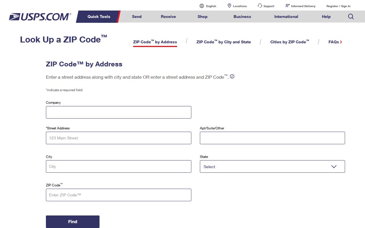
The two checks answer different questions. USPS validates delivery, but the Property Appraiser identifies the county parcel and the office responsible for its local records.
Census ZIP Code Tabulation Areas are also different from postal delivery routes. The Census explanation of ZCTAs shows why a statistical ZIP-shaped area should not choose the city or county permit custodian.

For a street directory search, use ZIP data to narrow and normalize. Use parcel jurisdiction to decide which local records office actually holds the address evidence.
Read Sarasota County Streets Across Time
Historical street work belongs in the Polk volume's street or reverse section when that section is present. A criss-cross directory lists entries by address rather than only by surname. Find the street, transcribe the relevant number range, then open the alphabetical entries to decode occupations, spouses, and abbreviations. Compare the next available year instead of treating one spelling or one vacancy mark as final.
- Parcel
- A mapped unit of land identified by the Property Appraiser.
- Situs address
- The physical address assigned to the property, distinct from the owner's mailing address.
- Plat
- A recorded map that fixes lots, blocks, streets, and subdivision boundaries.
- Criss-cross directory
- A directory arranged by street and house number for address-first research.
When the number or street name does not line up, use plats, Sanborn fire-insurance maps, the History Center's early maps and aerials, directory street guides, and the legal description. Sarasota County began in 1921, so older land work can cross into Manatee County books. The full historical collection is covered on the Sarasota County city directory page.
Sarasota County Street Directory Limits
A street directory built from official sources cannot name a complete household. The assessment roll identifies an assessed owner, not every occupant. A voter extract omits nonvoters and protected records. Permits name people in project roles, while deeds name title parties. Private utility and delivery data are not a substitute, and motor-vehicle personal information is restricted by federal law. An online no-match can also reflect spelling, coverage, a protected record, or the wrong jurisdiction.
Use the weakest accurate label for each finding: assessed owner, deed grantee, registered voter, permit applicant, or directory-listed occupant. That wording preserves the value of Sarasota County street directory research and avoids turning a dated public record into an unsupported claim about current residents.
Lawful use. Sarasota County address records support lawful personal research and civic inquiry. Never use them to stalk, harass, threaten, or expose a protected person.